Day Hike to The Ice Cave At Moose Mountain
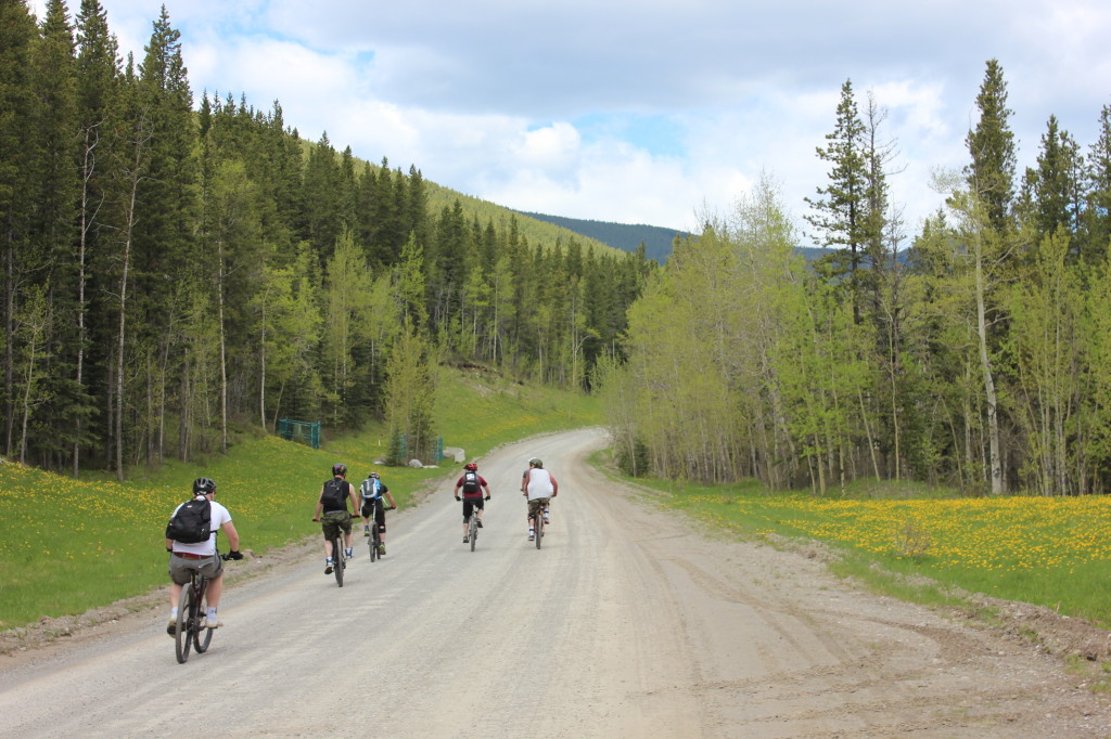
Down Hill Mountain Biking
We’ve done this hike a couple of times, and every time it’s always different. The last time we were at the Ice Cave was before the huge devastating flood of 2013 which took out bridges, roads, houses and the simple things, pathways. The season after the flood you can still see the after math of how powerful mother nature is with destructive deadfall pilled up at the stronger points, The local Oil & Gas companies have spent the time and effort at repairing the roads to access the plants which more often then not, the public uses to access paths that government roads don’t go to. We are grateful to have these companies to rebuild and maintain these roads on their budget, and not the tax payer dollar!!!
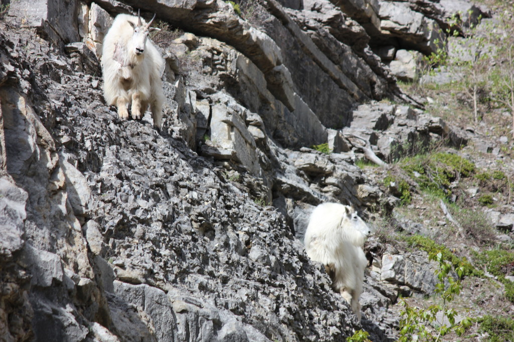
Mountain Goats
The parking lot is located just west of Bragg Creek on HWY 66, with a trek from the parking to the bottom of the mountain is 6km each way. So a day trip for the family, bikes are a great and easy to to pass this terrain, or if you are up for some good exercise and bonding time, the walk is another great way to enjoy the outdoors. We had our 10 year old Jack Russell come out for the hike, so we opted for the walk. The one advantage of walking is you take things at a slower pace, and can enjoy the wilderness. For most people that had ridden right past the Mountain Goats on the side of the road, however those who walked by had caught the wild animals out of the corner of their eye.
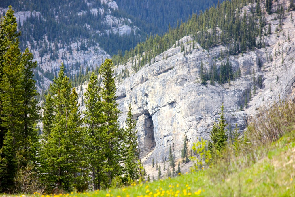
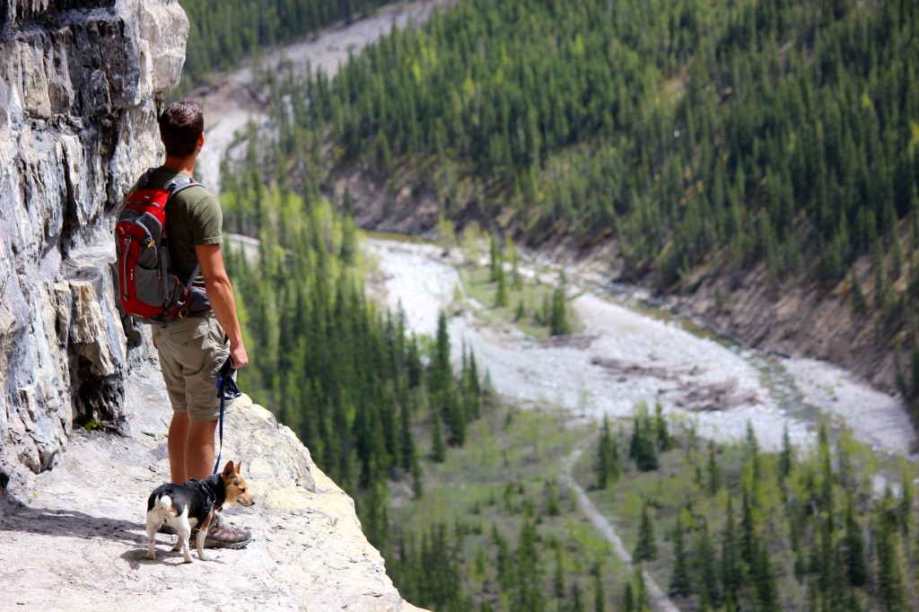
Looking Towards the Cave
At the 4km mark, you can look down the road and finally and see the entrance to the cave, and just how much vertical climb is ahead, but just how far up the mountain it really is. When you approach the end of the road, you will find another Oil & Gas plant and the marking for the path is on the right. Marked with the typical green hiking sign. Best place to leave your bike there, and start climbing with an altitude gain of from 4,720 feet to about 5,500 feet. The path starts off in the trees, with a lovely soil ground to walk on. Then changes quickly to loose shale, big boulders, and rocky ledges to climb over.
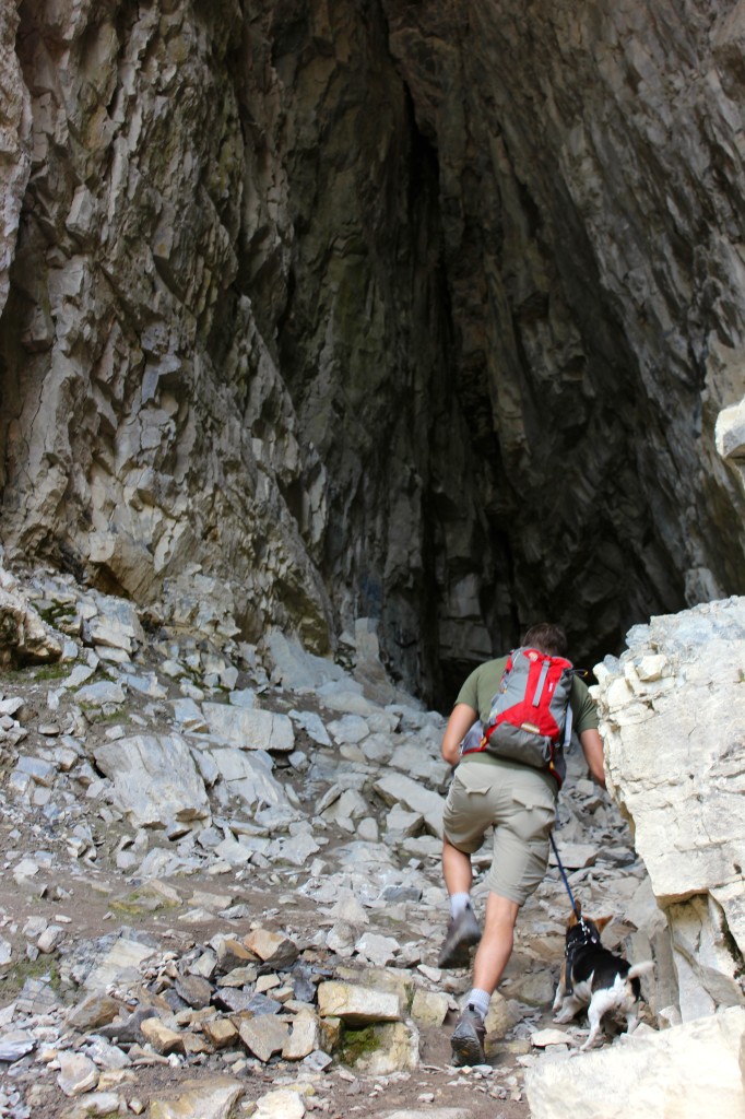
Tyler approaching the cave
Upon climbing the last little bit up in to the cave opening, the measurement of how large the cave really is starts to sink in, but the breath taking part is the view once you turn around to see what you just climbed up and accomplished, and the view is worth the climb. Taking a break to catch your breath and enjoy the view from the edge, you can feel the ice cold breeze escaping from the cave. If you are scared of heights, this might be a bit much.
Digging into the backpack to find the flashlight and putting the hoodie on to keep warm. Securing the backpack, we start the adventure into the cave. It gets cold fast, and the light seeps away quickly, only to see the “Light At The End Of The Tunnel” kinda feeling. Not long into the cave, we found the ice column. We are lucky this time to see the whole thing, sometimes there’s only half or no ice formations at all. This one was the best we seen yet. In the picture, it’s looks like a frozen waterfall!!
Looking Over The Valley
Checking to see if there is anything else around in the cave, and pushing your limits of “What’s really in the dark” feeling. We make our way back to the opening to warm up, and have a snack. If you are feeling adventurous, there is a large enough crack in the rocks that you can climb up, (if you are a skilled individual). Which will take you all the way to the top of the cave on the inside. Or from the back of the cave, there is a squeeze as well that takes you too the top, but it’s on the smaller side and the feeling of claustrophobic really sets in.
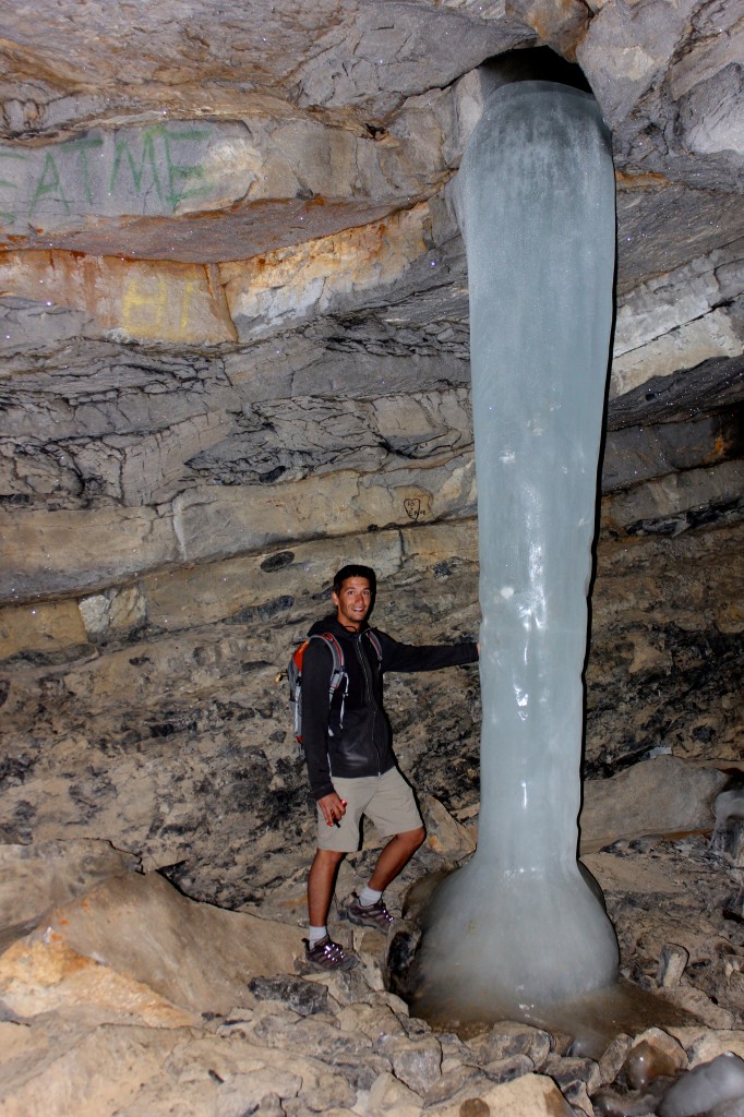
Tyler Beside The Ice Pillar
The descent down is simple, just go with gravity! You could try taking the path that brought you up there, but most never find it on the way back. Best way is to head down towards the river, you will end up on the river trail which is beautiful in the fall. Caution of falling rocks at all times.
Back at the bottom, it’s just a 6km road back to the parking lot. Parts of the year this hike is busy and you can see everyone out enjoying the outdoors. This time of the year in early spring, many Downhill Mountain bikers here because of the early season for them. Camping is not recommended in this valley because of the H2S (Sour Gas), which is identical to the smell of rotting eggs. You might smell this time to time while traveling down the road, but it’s not something to be concerned about, they valley is ways monitored incase there is ever an incident.
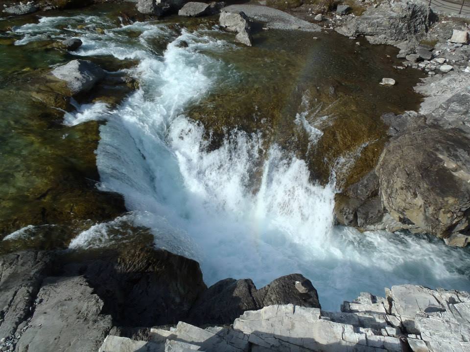
Elbow Falls
If you continue down on HWY 66 which located in Kananskis Country west of Bragg Creek, there is Elbow Falls which is a great location to have a picnic if you desire. This picture was taken while quading on the other side of the river, so a different point of view.
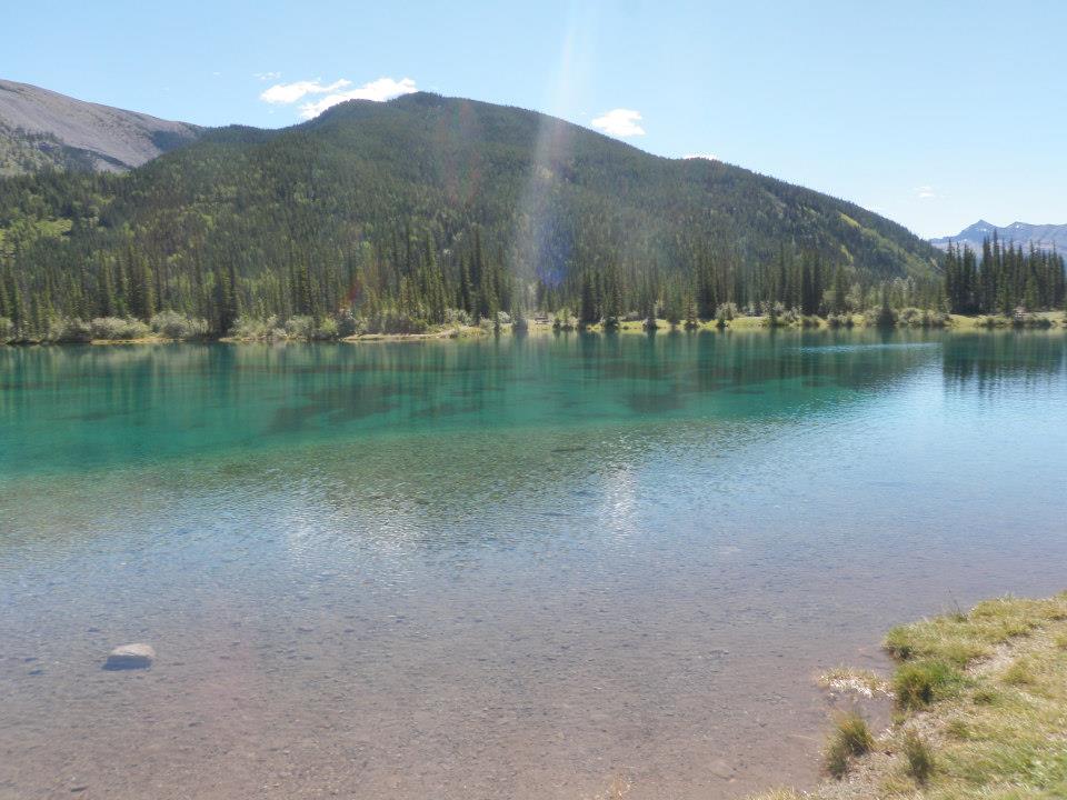
Forgetmenot Pond
And at the end of HWY 66 is Forgetmenot Pond; which is another cute place nestled in the mountains, and just above freezing all summer. Come for a picnic, walk around the lake, or a hike, many things to do here on HWY 66.


